Region: Rio Grande do Norte · Brazil
Extremoz travel guide
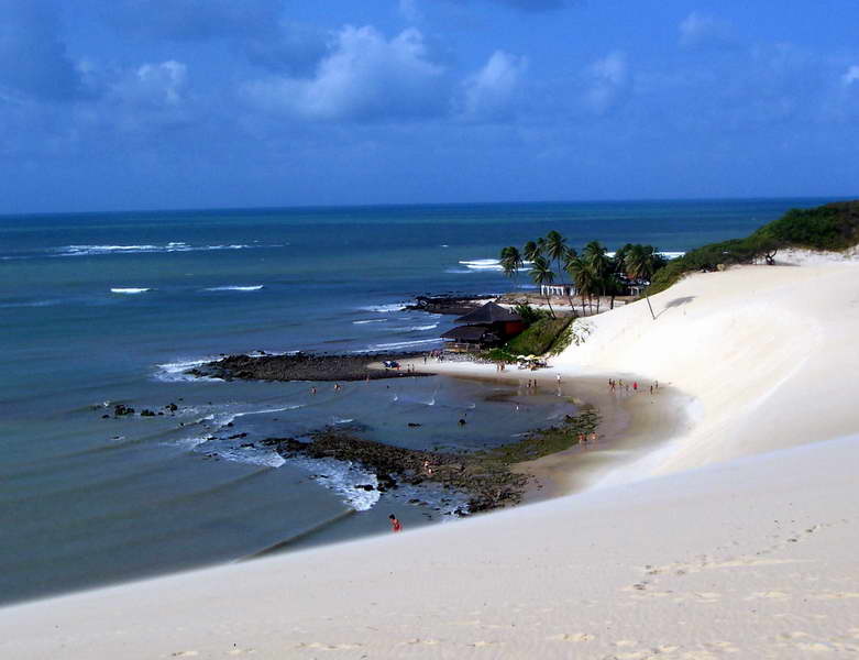

Extremoz is a city in Rio Grande do Norte, Brazil, home to about 69,000 people.
- Nearest airport
- NAT10 km · Rio Grande do Norte/São Gonçalo do Amarante-Governador Aluízio Alves International Airport
- Currency
- BRLBrazilian real
- Time zone
- America/FortalezaUTC-3
- Plugs
- C, N · 220 V
- Emergency
- 190
- Language
- Portuguese
Where to stay
More places to stay around Extremoz
Overture Maps and OpenStreetMap list 35 further hotels and other places to stay in the Extremoz area; none of them has a star rating and none has a room count.
By type: 20 hotels, guest houses, hostels and similar, 8 holiday rentals and apartments and 7 listed only as lodging.
The area is everything within 25 km that is nearer to Extremoz than to any other destination in this guide. Places this guide already names are not counted again; a place listed by two sources under different names can be counted twice.
Sources: Overture Maps Foundation, places theme, release 2026-09-23.1 (CDLA Permissive 2.0); © OpenStreetMap contributors (ODbL 1.0), data of 21 September 2026.
Things to see
Things to see near Extremoz
Places of interest within 6 km of the centre of Extremoz, none of them with an article in Wikipedia, ranked with those linked to Wikidata first, then by type of place and distance. Distances are in a straight line.
- Balneário de extremoz attraction · 0.8 km
OpenStreetMap maps 8 restaurants, no cafes and 2 bars and pubs within 6 km of the centre.
Source: © OpenStreetMap contributors (ODbL 1.0), map data of 21 September 2026.
Nature
Nature near Extremoz
Protected areas within 50 km
The list shows 20 of the 25 protected areas OpenStreetMap maps within 50 km: the nearest ones, by distance to their nearest edge.
- APA Lagoa Guaraíras área de proteção ambiental · 0.7 km
- Zona de Proteção Ambiental do Rio Doce zona de proteção ambiental · 4.0 km
- ZPA II A - Lixão de Guajirú zona de proteção ambiental · 5.3 km
- Parque Municipal Natural das Nascentes do Rio Golandim parque municipal · 5.7 km
- Área de Proteção Ambiental Rio Golandim área de proteção ambiental · 6.0 km
- Área de Proteção Ambiental de Jenipabu área de proteção ambiental · 8.2 km
- Zona de Proteção Ambiental 8 - Estuário do Rio Potengi zona de proteção ambiental · 8.7 km
- Parque Municipal Felipe Camarão parque municipal · 8.9 km
- Zona de Proteção Ambiental II C - Alagadiço da Sede zona de proteção ambiental · 9.4 km
- Zona de Proteção Ambiental III C - Mata Atlântica Jacaré-Mirim Guanduba zona de proteção ambiental · 10.1 km
- ZPA III B - Mata Atlântica Fazenda Arvoredo 10.3 km
- Reserva Particular do Patrimônio Natural Dunas Douradas reserva particular do patrimonio natural · 11.1 km
- ZPA III A - Mata Atlântica Fazenda Califórnia zona de proteção ambiental · 11.7 km
- Zona de Proteção Ambiental 7 - Forte dos Reis Magos zona de proteção ambiental · 13.0 km
- ZPA 04 - Cordões dunares do Guarapes zona de proteção ambiental · 13.2 km
- Parque das Dunas parque estadual · 15.5 km
- ZPA 01 - Campos Dunares Pitimbu, Candelária e Cidade Nova zona de proteção ambiental · 15.9 km
- Parque da Cidade Dom Nivaldo Monte parque municipal · 16.2 km
- Zona de Proteção Ambiental 10 - Mãe Luiza zona de proteção ambiental · 16.6 km
- ZPA 03 - Rio Pitimbu zona de proteção ambiental · 18.0 km
Beaches within 15 km
- Praia de Barra do Rio 10.6 km
- Praia de Jenipabu 10.9 km
- Praia de Graçandu 11.5 km
- Santa Rita 12.4 km
- Redinha 12.6 km
- Praia de Pitangui 12.7 km
- Praia do Y 13.1 km
- Praia do Forte 13.8 km
- Praia do Meio 14.6 km
Source: © OpenStreetMap contributors (ODbL 1.0), map data of 21 September 2026; links to Wikidata.
When to go
The best time to visit Extremoz
Extremoz has no month that is both mild and dry by the measure used here. February is the warmest month, with average highs of 32 °C; June is the wettest, with about 218 mm of rain.
Comfortable means average daytime high between 18 °C and 29 °C and under 80 mm of rain in the month. Averages for 1991-2020 over the surrounding area, a grid square about 50 km across, so a coast or a nearby mountain can make the town itself warmer or cooler. Data: CRU TS v4.10, Climatic Research Unit, University of East Anglia (Open Database License).
Public holidays in Brazil, 2026
Shops and offices may close on these dates.
Getting there
Getting to Extremoz: airports and arrival
The nearest airport with scheduled flights is Rio Grande do Norte/São Gonçalo do Amarante-Governador Aluízio Alves International Airport (NAT), about 9.7 km from the city centre in a straight line.
NAT · Rio Grande do Norte/São Gonçalo do Amarante-Governador Aluízio Alves International Airport
Questions
Extremoz: questions travellers ask
When is the best time to visit Extremoz?
Extremoz has no month that is both mild and dry by the measure used here. February is the warmest month, with average highs of 32 °C; June is the wettest, with about 218 mm of rain.
Which airport is closest to Extremoz?
The nearest airport with scheduled flights is Rio Grande do Norte/São Gonçalo do Amarante-Governador Aluízio Alves International Airport (NAT), about 9.7 km from the city centre in a straight line.
What currency is used in Extremoz?
The Brazilian real (BRL), per Unicode CLDR.
Nearby
Destinations near Extremoz
Sources: city facts from Wikidata and Wikipedia; airports from OurAirports; climate from CRU TS v4.10 (University of East Anglia Climatic Research Unit), 1991-2020 monthly means, 0.5° grid; public holidays from python-holidays (MIT); currency and official languages from Unicode CLDR (Unicode License v3); time zone from the coordinates (timezone-boundary-builder, ODbL) with offsets from the IANA Time Zone Database; places to stay and guest scores from each operator's own public pages; amenities from the operators' own listing data. How this guide is made.