Region: Inner Mongolia · China
Hohhot travel guide
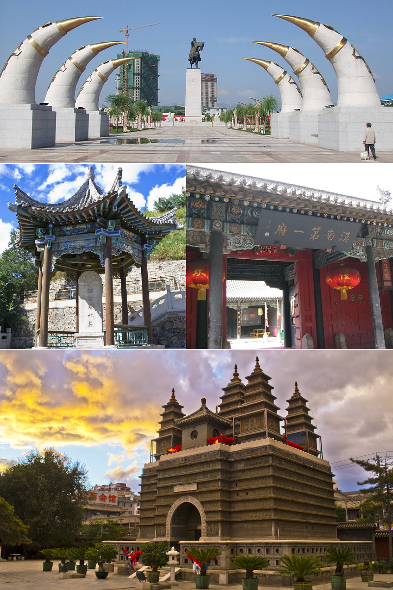

Hohhot is a city in Inner Mongolia, China, home to about 3,446,000 people.
- Best months
- May, June and September
- Nearest airport
- HET14 km · Hohhot Baita International Airport
- Currency
- CNYChinese yuan
- Time zone
- Asia/ShanghaiUTC+8
- Plugs
- A, C, I · 220 V
- Emergency
- 110
- Language
- Chinese
About
About Hohhot
Hohhot, formerly known as Guihua or Kweisui (Guisui), is the capital and largest city of the northern Chinese autonomous region of Inner Mongolia, serving as the region's administrative, economic and cultural center.
Hohhot is a combination of two Mongolian words: Hoh ('blue') and Hot ('city'). Thus, Hohhot means "blue city". Hohhot has only been the capital of Inner Mongolia since 1947 but is rapidly growing and challenging Baotou as the region's industrial and economic powerhouse. Although only around 11% of the city's population are indigenous Mongols, Mongolian Buddhism (an offshoot of Tibetan Buddhism) continues to thrive and Mongolian culture is actively preserved. As a new capital, the city lacks an abundance of historical and tourist sites.
Wikipedia and Wikivoyage contributors, CC BY-SA 4.0; excerpted.
Things to do
What to see and do in Hohhot
See
- Da Zhao Temple
- Xilitu Zhao
- Inner Mongolia Museum
- Temple of the Five Pagodas
- Tomb of Princess Zhaojun
- Great Mosque of Hohhot
- Hohhot Museum
- Inner Mongolia Art Museum
- Inner Mongolia Museum of Natural History
- Inner Mongolia Science and Technology Museum
- Yili Health Valley
Do
- Dazhao Temple Festivals
- Get to the mountains
- The Great Wall
- Wind Turbines
- People's Park
- Go Dojo
Wikivoyage contributors, CC BY-SA 4.0; excerpted.
Where to stay
Hotels in Hohhot
2 hotels within 25 km of the centre, as recorded in Wikidata. Each name links to its encyclopedia article where there is one.
| Hotel | Opened | From centre |
|---|---|---|
| Phoenix Hotel | 3.4 km | |
| Yunyi Zizai Hotel (Hohhot Meteorological Bureau Military Area) | 3.3 km |
Where to stay
More places to stay around Hohhot
Overture Maps and OpenStreetMap list 40 further hotels and other places to stay in the Hohhot area; none of them has a star rating and none has a room count.
By type: 40 hotels, guest houses, hostels and similar, no holiday rentals and none listed only as lodging.
The area is everything within 25 km that is nearer to Hohhot than to any other destination in this guide. Places this guide already names are not counted again; a place listed by two sources under different names can be counted twice.
Sources: Overture Maps Foundation, places theme, release 2026-09-23.1 (CDLA Permissive 2.0); © OpenStreetMap contributors (ODbL 1.0), data of 21 September 2026.
Things to see
Things to see near Hohhot
Places of interest within 10 km of the centre of Hohhot, ranked first by how widely they are covered in Wikipedia (4 of them have articles), then the others, those linked to Wikidata first, by type of place and distance. Distances are in a straight line.
- Residence of Princess Heshuo Kejing museum · 2.8 km
- 绥远城将军衙署 museum · 1.8 km
- Monastery "Ust Juu" attraction · 8.8 km
- Ulanhu Park park · 2.2 km
- Inner Mongolia Museum museum · 8.5 km
- 呼和浩特博物馆 museum · 0.9 km
- 呼和浩特儿童探索博物馆 museum · 0.9 km
- 绥蒙抗日救国会旧址纪念馆 museum · 2.4 km
- 多松年烈士纪念馆 museum · 3.7 km
- 内蒙古自然博物馆 museum · 4.4 km
- 内蒙古科技馆 museum · 6.4 km
- Aertai Amusement Park theme park · 4.9 km
- Daqingshan Wildlife Zoo zoo · 8.4 km
- 佐领衙署 attraction · 2.2 km
- 内蒙古数字文旅新天地 attraction · 6.3 km
- Inner Mongolia Art Museum gallery · 6.6 km
- 呼和浩特雕塑艺术馆 gallery · 6.2 km
- Qingcheng Park park · 1.0 km
- Manduhai Park park · 1.6 km
- Beijiao Park park · 3.4 km
Source: © OpenStreetMap contributors (ODbL 1.0), map data of 21 September 2026; links to Wikidata.
Nature
Nature near Hohhot
Protected areas within 50 km
- 哈达门国家森林公园 15.4 km
Ski areas within 40 km
- 北极光滑雪场 1 lift · 8.4 km
- 大青山太伟滑雪场 3 lifts · 19.9 km
- 马鬃山滑雪场 6 lifts · 38.0 km
Source: © OpenStreetMap contributors (ODbL 1.0), map data of 21 September 2026.
When to go
The best time to visit Hohhot
The most comfortable months for a city stay in Hohhot are May, June and September. July is the warmest month, with average highs of 28 °C; July is the wettest, with about 101 mm of rain.
Comfortable means average daytime high between 18 °C and 29 °C and under 80 mm of rain in the month. Averages for 1991-2020 over the surrounding area, a grid square about 50 km across, so a coast or a nearby mountain can make the town itself warmer or cooler. Data: CRU TS v4.10, Climatic Research Unit, University of East Anglia (Open Database License).
Public holidays in China, 2026
Shops and offices may close on these dates.
Getting there
Getting to Hohhot: airports and arrival
The nearest airport with scheduled flights is Hohhot Baita International Airport (HET), about 14 km from the city centre in a straight line; Ulanqab Jining Airport (UCB, 126 km) and Baotou Donghe International Airport (BAV, 143 km) are also within reach.
Getting around
Hohhot Metro has two lines. Line 1 runs from east to west between Hohhot Baita Airport in Saihan District & Yili Health Valley in Tumed Left Banner. Line 2 runs from north to south and connect with Line 1 at Xinhua Square Station. Hohhot and Hohhot East railway stations are both connected to the metro but Hohhot East is more seamlessly integrated. Signs and announcements in the Metro are trilingual in Mandarin, Mongolian and English. In 2024, the addition of the No. 2 subway line goes through the entire city and is also very convenient.
Wikivoyage contributors, CC BY-SA 4.0; excerpted.
HET · Hohhot Baita International Airport
UCB · Ulanqab Jining Airport
BAV · Baotou Donghe International Airport
Getting around
Getting there and around Hohhot by rail and ferry
Rail from the airports
Rail, metro and tram lines that call at a station at the airport, as mapped in OpenStreetMap.
- HET · Hohhot Baita International AirportMetro (呼和浩特地铁): 1
Metro, light rail and tram
- 呼和浩特地铁 (Metro): 2 lines, 44 stations in HohhotLines: 1, 2
Source: © OpenStreetMap contributors (ODbL 1.0), map data of 21 September 2026.
Local knowledge
Eating, drinking and staying safe in Hohhot
Eat
Those looking for halal food will find it in restaurants with green or yellow signs, most of which are halal. To be sure, look for the Arabic word حلال on the sign.
Drink
There are local speciality drinks and well-known milk brands such as Yili and Mengniu.
Wikivoyage contributors, CC BY-SA 4.0; excerpted.
Questions
Hohhot: questions travellers ask
When is the best time to visit Hohhot?
The most comfortable months for a city stay in Hohhot are May, June and September. July is the warmest month, with average highs of 28 °C; July is the wettest, with about 101 mm of rain.
Which airport is closest to Hohhot?
The nearest airport with scheduled flights is Hohhot Baita International Airport (HET), about 14 km from the city centre in a straight line; Ulanqab Jining Airport (UCB, 126 km) and Baotou Donghe International Airport (BAV, 143 km) are also within reach.
What currency is used in Hohhot?
The Chinese yuan (CNY), per Unicode CLDR.
Nearby
Destinations near Hohhot
Sources: city facts from Wikidata and Wikipedia; airports from OurAirports; climate from CRU TS v4.10 (University of East Anglia Climatic Research Unit), 1991-2020 monthly means, 0.5° grid; public holidays from python-holidays (MIT); currency and official languages from Unicode CLDR (Unicode License v3); time zone from the coordinates (timezone-boundary-builder, ODbL) with offsets from the IANA Time Zone Database; places to stay and guest scores from each operator's own public pages; amenities from the operators' own listing data. How this guide is made.