Region: Pennsylvania · United States
Where to stay in Lower Merion Township
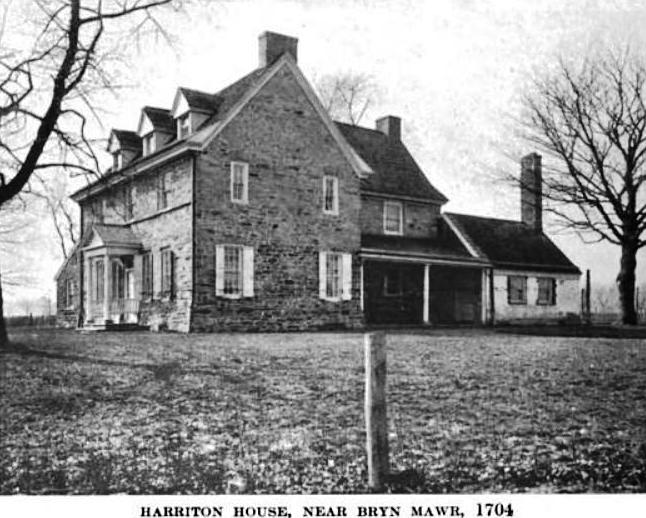

Lower Merion Township is a city in Pennsylvania, United States, home to about 64,000 people.
- Nearest airport
- PHL13 km · Philadelphia International Airport
- Currency
- USDUS dollar
- Time zone
- America/New YorkUTC-5, UTC-4 with daylight saving time
- Plugs
- A, B · 120 V
- Emergency
- 911
- Language
- English
Where to stay
Hotels in Lower Merion Township
3 hotels within 25 km of the centre, as recorded in Wikidata. Each name links to its encyclopedia article where there is one.
| Hotel | Opened | From centre |
|---|---|---|
| General Wayne Inn | 3.1 km | |
| Walnut Park Plaza Hotel | 3.1 km | |
| Wissahickon Hall | 1850 | 6.7 km |
Where to stay
More places to stay around Lower Merion Township
Overture Maps and OpenStreetMap list 46 further hotels and other places to stay in the Lower Merion Township area; none of them has a star rating and 1 has a room count.
By type: 21 hotels, guest houses, hostels and similar, 1 holiday rental or apartment and 24 listed only as lodging.
The area is everything within 25 km that is nearer to Lower Merion Township than to any other destination in this guide. Places this guide already names are not counted again; a place listed by two sources under different names can be counted twice.
Sources: Overture Maps Foundation, places theme, release 2026-09-23.1 (CDLA Permissive 2.0); © OpenStreetMap contributors (ODbL 1.0), data of 21 September 2026.
Things to see
Things to see near Lower Merion Township
Places of interest within 6 km of the centre of Lower Merion Township, ranked first by how widely they are covered in Wikipedia (5 of them have articles), then the others, those linked to Wikidata first, by type of place and distance. Distances are in a straight line.
- West Fairmount Park park · 5.0 km
- Shofuso Japanese House and Garden attraction · 4.6 km
- Please Touch Museum museum · 4.9 km
- Smith Memorial Arch monument · 5.1 km
- Mount Pleasant museum · 5.7 km
- Nitre Hall museum · 1.9 km
- Maguire Art Museum museum · 2.7 km
- Underground Railroad Museum at Belmont Mansion museum · 4.6 km
- Paul Robeson House & Museum museum · 4.9 km
- New Africa Center museum · 5.2 km
- Cedar Grove museum · 5.3 km
- American Bandstand attraction · 5.3 km
- Axiom Contemporary gallery · 3.2 km
- Soft Illusions Fine Art Gallery gallery · 6.0 km
- Morris Park park · 0.8 km
- Carroll Park park · 1.5 km
- Cobbs Creek Park park · 2.7 km
- Gillespie Park park · 5.9 km
- Georges Hill peak, 64 m · 3.6 km
OpenStreetMap maps 200 restaurants, 45 cafes and 36 bars and pubs within 6 km of the centre.
Source: © OpenStreetMap contributors (ODbL 1.0), map data of 21 September 2026; links to Wikidata.
Nature
Nature near Lower Merion Township
Protected areas within 50 km
The list shows 20 of the 38 protected areas OpenStreetMap maps within 50 km: the nearest ones, by distance to their nearest edge.
- Mill Creek Valley Park City · 5.3 km
- Ivy Ridge Greenway 6.0 km
- Wissahickon Valley Park City Owned Park · 6.2 km
- John Heinz National Wildlife Refuge National Wildlife Refuge · 9.5 km
- Fort Washington State Park State Park · 12.8 km
- Petty's Island Preserve Preserve · 12.9 km
- Ridley Creek State Park State Park · 13.5 km
- Willow Lake Farm Protected landscape · 17.2 km
- Four Mills Nature Reserve Protected landscape · 17.9 km
- Valley Forge National Historical Park National Historical Park · 18.1 km
- Armentrout Preserve Protected landscape · 19.0 km
- Wissahickon Waterfowl Preserve Protected landscape · 19.2 km
- Penllyn Natural Area Protected landscape · 20.6 km
- Crossways Preserve Protected landscape · 20.9 km
- Almonesson Creek Park 22.9 km
- Evansburg State Park State Park · 23.9 km
- Tall Pines State Preserve State Preserve · 24.8 km
- Byrne Family Preserve Protected Landscape · 25.4 km
- Dodsworth Run Preserve Protected landscape · 26.3 km
- Brinton Run Preserve conservation easement · 27.1 km
Ski areas within 40 km
- Wissahickon Ski Club 1 lift · 10.2 km
- Spring Mountain Ski Area 6 lifts · 35.7 km
Source: © OpenStreetMap contributors (ODbL 1.0), map data of 21 September 2026; links to Wikidata.
When to go
The best time to visit Lower Merion Township
Lower Merion Township has no month that is both mild and dry by the measure used here. July is the warmest month, with average highs of 31 °C; July is the wettest, with about 122 mm of rain.
Comfortable means average daytime high between 18 °C and 29 °C and under 80 mm of rain in the month. Averages for 1991-2020 over the surrounding area, a grid square about 50 km across, so a coast or a nearby mountain can make the town itself warmer or cooler. Data: CRU TS v4.10, Climatic Research Unit, University of East Anglia (Open Database License).
Public holidays in United States, 2026
Shops and offices may close on these dates.
Getting there
Getting to Lower Merion Township: airports and arrival
The nearest airport with scheduled flights is Philadelphia International Airport (PHL), about 13 km from the city centre in a straight line; Wilmington Airport (ILG, 45 km) and Trenton Mercer Airport (TTN, 51 km) are also within reach.
PHL · Philadelphia International Airport
ILG · Wilmington Airport
TTN · Trenton Mercer Airport
Getting around
Getting there and around Lower Merion Township by rail and ferry
Rail from the airports
Rail, metro and tram lines that call at a station at the airport, as mapped in OpenStreetMap.
- PHL · Philadelphia International AirportRail (SEPTA): AIR
Source: © OpenStreetMap contributors (ODbL 1.0), map data of 21 September 2026.
Questions
Lower Merion Township: questions travellers ask
When is the best time to visit Lower Merion Township?
Lower Merion Township has no month that is both mild and dry by the measure used here. July is the warmest month, with average highs of 31 °C; July is the wettest, with about 122 mm of rain.
Which airport is closest to Lower Merion Township?
The nearest airport with scheduled flights is Philadelphia International Airport (PHL), about 13 km from the city centre in a straight line; Wilmington Airport (ILG, 45 km) and Trenton Mercer Airport (TTN, 51 km) are also within reach.
What currency is used in Lower Merion Township?
The US dollar (USD), per Unicode CLDR.
Nearby
Destinations near Lower Merion Township
Sources: city facts from Wikidata and Wikipedia; airports from OurAirports; climate from CRU TS v4.10 (University of East Anglia Climatic Research Unit), 1991-2020 monthly means, 0.5° grid; public holidays from python-holidays (MIT); currency and official languages from Unicode CLDR (Unicode License v3); time zone from the coordinates (timezone-boundary-builder, ODbL) with offsets from the IANA Time Zone Database; places to stay and guest scores from each operator's own public pages; amenities from the operators' own listing data. How this guide is made.