Region: New York region · United States
Oyster Bay travel guide
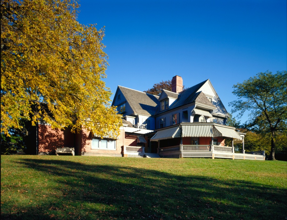

Oyster Bay is a city in New York, United States, home to about 301,000 people.
- Nearest airport
- JFK27 km · John F. Kennedy International Airport
- Currency
- USDUS dollar
- Time zone
- America/New YorkUTC-5, UTC-4 with daylight saving time
- Plugs
- A, B · 120 V
- Emergency
- 911
- Language
- English
About
About Oyster Bay
The Town of Oyster Bay is the easternmost of the three towns that make up Nassau County, New York, United States. Part of the New York metropolitan area, it is the only town in Nassau County to extend from the North Shore to the South Shore of Long Island.
The northern half of the Town of Oyster Bay has long been known for its large estates, rolling hills, and rural & rustic feel. It is in stark contrast to the portions of the town south of the Long Island Expressway. Many famous people have called this portion of Oyster Bay home over the years - perhaps most famously U.S. President Theodore Roosevelt (whose Sagamore Hill estate in Cove Neck is now a public museum operated by the U.S. National Park Service).
Wikipedia and Wikivoyage contributors, CC BY-SA 4.0; excerpted.
Things to do
What to see and do in Oyster Bay
See
Oyster Bay is quite an old town, having been established in the 17th century, and it is absolutely chock-full of great old buildings, only a few of which are pictured in this article.
- Bailey Arboretum
- Cold Spring Harbor Laboratory
- Muttontown Preserve
- Oyster Bay History Walk
- Planting Fields Arboretum
- Sagamore Hill
Do
There are also parks, including Theodore Roosevelt Memorial Park. Theodore Roosevelt spent several summers as President in Oyster Bay (now the nearby hamlet of Cove Neck) and died and was buried there. However, if there are signs at parks saying "Residents only," you may be out of luck in that respect.
- Bayville Adventure Park
Wikivoyage contributors, CC BY-SA 4.0; excerpted.
Where to stay
Hotels in Oyster Bay
2 hotels within 25 km of the centre, as recorded in Wikidata. Each name links to its encyclopedia article where there is one.
| Hotel | Opened | From centre |
|---|---|---|
| Marriott Melville Long Island | 7.3 km | |
| The Inn At Fox Hollow Hotel | 6.2 km |
Where to stay
More places to stay around Oyster Bay
Overture Maps and OpenStreetMap list 44 further hotels and other places to stay in the Oyster Bay area; none of them has a star rating and none has a room count.
By type: 24 hotels, guest houses, hostels and similar, 1 holiday rental or apartment and 19 listed only as lodging.
The area is everything within 25 km that is nearer to Oyster Bay than to any other destination in this guide. Places this guide already names are not counted again; a place listed by two sources under different names can be counted twice.
Sources: Overture Maps Foundation, places theme, release 2026-09-23.1 (CDLA Permissive 2.0); © OpenStreetMap contributors (ODbL 1.0), data of 21 September 2026.
Things to see
Things to see near Oyster Bay
Places of interest within 6 km of the centre of Oyster Bay, ranked first by how widely they are covered in Wikipedia (6 of them have articles), then the others, those linked to Wikidata first, by type of place and distance. Distances are in a straight line.
- Bethpage State Park park · 4.1 km
- Cantiague Park park · 3.8 km
- Hicksville Gregory Museum museum · 1.8 km
- Old Bethpage Village Restoration park · 4.9 km
- Syosset Woodbury Community Park park · 6.0 km
- Mannetto Hills peak, 85 m · 5.8 km
- Long Island Fair Exhibition Hall museum · 4.8 km
- Old Bethpage Village Restoration Visitor Center museum · 5.1 km
- Museum of American Armor museum · 5.2 km
- Battle Row Campground park · 4.3 km
- Peter C. Collins Soccer Park park · 4.5 km
- Ellsworth W. Allen Park park · 5.8 km
- Manetto Hills Park park · 5.9 km
OpenStreetMap maps 118 restaurants, 17 cafes and 13 bars and pubs within 6 km of the centre.
Source: © OpenStreetMap contributors (ODbL 1.0), map data of 21 September 2026; links to Wikidata.
Nature
Nature near Oyster Bay
Protected areas within 50 km
The list shows 20 of the 37 protected areas OpenStreetMap maps within 50 km: the nearest ones, by distance to their nearest edge.
- Underhill Preserve Special Use · 5.0 km
- Old Westbury Unique Area Unique Area · 8.1 km
- Oyster Bay National Wildlife Refuge National Wildlife Refuge · 12.5 km
- Sagamore Hill National Historic Site National Historic Site · 13.8 km
- Babylon Marsh-Elder And Petteanger Island Tidal Wetland Area Tidal Wetland · 15.7 km
- Edgewood Oak Brush Plains Preserve Unique Area · 16.2 km
- Target Rock National Wildlife Refuge National Wildlife Refuge · 19.2 km
- Lido Beach Tidal Wetlands Area Tidal Wetland · 19.9 km
- Udall's Cove And Ravine Natural Resource Area Natural Resource Area · 19.9 km
- Isbrandtsen Marsh Tidal Wetlands Area Tidal Wetland · 20.4 km
- Seatuck National Wildlife Refuge National Wildlife Refuge · 25.0 km
- Inwood Bay State Tidal Wetland Tidal Wetland · 25.1 km
- Fire Island National Seashore National Seashore · 25.3 km
- Titus Mill Pond State Tidal Wetlands Tidal Wetland · 27.7 km
- Stewart B. McKinney National Wildlife Refuge National Wildlife Refuge · 28.1 km
- Norton Basin Natural Resource Area Natural Resource Area · 28.4 km
- Pickman-Rimmer State Tidal Wetland Tidal Wetland · 29.5 km
- Timber Point Tidal Wetlands Area Tidal Wetland · 30.1 km
- Saint Paul's Church National Historic Site National Historic Site · 30.9 km
- Pepperidge Hall Marsh State Tidal Wetland Tidal Wetland · 31.0 km
Beaches within 15 km
- Alhambra Beach 11.7 km
- Cold Spring Beach 12.4 km
- Eagle Dock Beach 13.0 km
- Beekman Beach 13.4 km
- Amityville Beach 14.1 km
- Copiague Beach 14.5 km
Source: © OpenStreetMap contributors (ODbL 1.0), map data of 21 September 2026; links to Wikidata.
When to go
The best time to visit Oyster Bay
Oyster Bay has no month that is both mild and dry by the measure used here. July is the warmest month, with average highs of 29 °C; March is the wettest, with about 111 mm of rain.
Comfortable means average daytime high between 18 °C and 29 °C and under 80 mm of rain in the month. Averages for 1991-2020 over the surrounding area, a grid square about 50 km across, so a coast or a nearby mountain can make the town itself warmer or cooler. Data: CRU TS v4.10, Climatic Research Unit, University of East Anglia (Open Database License).
Public holidays in United States, 2026
Shops and offices may close on these dates.
Getting there
Getting to Oyster Bay: airports and arrival
The nearest airport with scheduled flights is John F. Kennedy International Airport (JFK), about 27 km from the city centre in a straight line; LaGuardia Airport (LGA, 31 km) and Long Island MacArthur Airport (ISP, 34 km) are also within reach.
Getting in
Oyster Bay is the last stop on the Oyster Bay Branch of the Long Island Rail Road. Other LIRR stations in this part of the town include Locust Valley on the Oyster Bay Branch and Syosset on the Port Jefferson Branch.
Getting around
For the most part, you will need a car to travel around this portion of the Town of Oyster Bay. Except for the westernmost areas (i.e.: the areas near the shore of Hempstead Harbor) and parts of the Syosset & Woodbury areas, there are no public bus services available. Most of the downtown areas and many surrounding neighborhoods (i.e.: Greenvale, East Norwich, Syosset, the communities along Hempstead Harbor, etc.) have streets with sidewalks, but the more rural areas (i.e.: the Brookvilles, Laurel Hollow, Lattingtown, Cove Neck, Centre Island, etc.) have very few, if any.
Wikivoyage contributors, CC BY-SA 4.0; excerpted.
JFK · John F. Kennedy International Airport
LGA · LaGuardia Airport
ISP · Long Island MacArthur Airport
Getting around
Getting there and around Oyster Bay by rail and ferry
Rail from the airports
Rail, metro and tram lines that call at a station at the airport, as mapped in OpenStreetMap.
- JFK · John F. Kennedy International AirportLight rail (AirTrain JFK): JFK
Source: © OpenStreetMap contributors (ODbL 1.0), map data of 21 September 2026.
Local knowledge
Eating, drinking and staying safe in Oyster Bay
Stay safe
In terms of crime, there really is not too much you need to worry about. Northern Oyster Bay, just like much of the southern half of Oyster Bay, is extremely safe at all times of the day and night. Just be sure to drive carefully and look out for cars when walking on streets lacking sidewalks and you should not encounter any issues. The locals take pride in their community and are very serious when it comes to crime. Any inappropriate or malicious behavior will be noticed very quickly and will not be tolerated. In an emergency, just as you would anywhere else in the United States, dial 911.
Wikivoyage contributors, CC BY-SA 4.0; excerpted.
Questions
Oyster Bay: questions travellers ask
When is the best time to visit Oyster Bay?
Oyster Bay has no month that is both mild and dry by the measure used here. July is the warmest month, with average highs of 29 °C; March is the wettest, with about 111 mm of rain.
Which airport is closest to Oyster Bay?
The nearest airport with scheduled flights is John F. Kennedy International Airport (JFK), about 27 km from the city centre in a straight line; LaGuardia Airport (LGA, 31 km) and Long Island MacArthur Airport (ISP, 34 km) are also within reach.
What currency is used in Oyster Bay?
The US dollar (USD), per Unicode CLDR.
Nearby
Destinations near Oyster Bay
Sources: city facts from Wikidata and Wikipedia; airports from OurAirports; climate from CRU TS v4.10 (University of East Anglia Climatic Research Unit), 1991-2020 monthly means, 0.5° grid; public holidays from python-holidays (MIT); currency and official languages from Unicode CLDR (Unicode License v3); time zone from the coordinates (timezone-boundary-builder, ODbL) with offsets from the IANA Time Zone Database; places to stay and guest scores from each operator's own public pages; amenities from the operators' own listing data. How this guide is made.