Region: England · United Kingdom
Where to stay in Lancashire
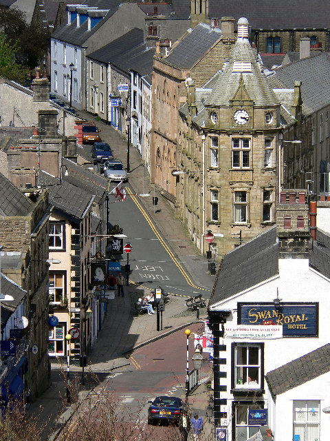

Lancashire is a city in England, United Kingdom, home to about 1,515,000 people.
- Nearest airport
- LPL54 km · Liverpool John Lennon Airport
- Currency
- GBPBritish pound
- Time zone
- Europe/LondonUTC+0, UTC+1 with daylight saving time
- Plugs
- G · 230 V
- Emergency
- 112
- Language
- English
About
About Lancashire
Lancashire ( LANG-kə-shər, -sheer; abbreviated Lancs) is a ceremonial county in North West England. It is bordered by Cumbria to the north, North Yorkshire and West Yorkshire to the east, Greater Manchester and Merseyside to the south, and the Irish Sea to the west.
Lancashire takes its name from the city of Lancaster, which was the Roman camp (castrum) by the River Lune. It is known for its longstanding rivalry with the neighbouring county of Yorkshire. Lancashire was much reduced by the 1974 local government re-organisation: northerly Barrow-in-Furness was re-assigned to Cumbria, while Greater Manchester and Merseyside (including the port city of Liverpool) became separate areas. This means that the most heavily industrial areas have parted, while the rural charms have remained.
Wikipedia and Wikivoyage contributors, CC BY-SA 4.0; excerpted.
Where to stay
Where the places to stay in Lancashire are
13 places to stay in this guide with known coordinates, grouped by straight-line distance from the city centre (the point Wikidata gives for Lancashire), nearest first. Distance on foot or by road is longer.
9 places
- Towneley Arms Hotel · 3.6 km
- Haighton Manor · 3.9 km
- The Feilden's Arms · 4.4 km
- The White Bull · 4.6 km
- The Grapes Inn · 5.5 km
- Punch Bowl Inn · 7.9 km
- Shireburn Arms Hotel And Stable Block Adjoining At Right Angles To The East · 8.9 km
- Gibbon Bridge Hotel · 9.1 km
- Talbot Hotel · 9.6 km
4 places
- Wolfen Mill · 10.3 km
- Red Pump Inn · 12.9 km
- The Inn at Whitewell · 14.0 km
- Edisford Bridge Inn · 14.1 km
Where to stay
Hotels in Lancashire
13 hotels within 25 km of the centre, as recorded in Wikidata. Each name links to its encyclopedia article where there is one.
| Hotel | Opened | From centre |
|---|---|---|
| Punch Bowl Inn | 7.9 km | |
| The Inn at Whitewell | 14.0 km | |
| The White Bull | 4.6 km | |
| Edisford Bridge Inn | 14.1 km | |
| Gibbon Bridge Hotel | 9.1 km | |
| Haighton Manor | 3.9 km | |
| Red Pump Inn | 12.9 km | |
| Shireburn Arms Hotel And Stable Block Adjoining At Right Angles To The East | 8.9 km | |
| Talbot Hotel | 1779 | 9.6 km |
| The Feilden's Arms | 4.4 km | |
| The Grapes Inn | 5.5 km | |
| Towneley Arms Hotel | 3.6 km | |
| Wolfen Mill | 10.3 km |
All 13 hotels in Lancashire, with their history and operators
Where to stay
Hotels near venues in Lancashire
Stadiums, venues, stations and sights in Lancashire, each with the places to stay near it by straight-line distance.
Where to stay
More places to stay around Lancashire
Overture Maps and OpenStreetMap list 51 further hotels and other places to stay in the Lancashire area; none of them has a star rating and none has a room count.
By type: 39 hotels, guest houses, hostels and similar, 11 holiday rentals and apartments and 1 listed only as lodging.
The area is everything within 25 km that is nearer to Lancashire than to any other destination in this guide. Places this guide already names are not counted again; a place listed by two sources under different names can be counted twice.
Sources: Overture Maps Foundation, places theme, release 2026-09-23.1 (CDLA Permissive 2.0); © OpenStreetMap contributors (ODbL 1.0), data of 21 September 2026.
Things to see
Things to see near Lancashire
Places of interest within 10 km of the centre of Lancashire, ranked first by how widely they are covered in Wikipedia (13 of them have articles), then the others, those linked to Wikidata first, by type of place and distance. Distances are in a straight line.
- Harris Museum museum · 7.9 km
- Longridge Fell peak, 350 m · 8.8 km
- Bremetennacum archaeological site · 4.5 km
- Inglewhite Cross monument · 8.4 km
- Blackburn Museum and Art Gallery museum · 9.4 km
- Hoghton Tower attraction · 7.7 km
- Beacon Fell peak, 266 m · 9.8 km
- Ribchester Roman Museum museum · 4.6 km
- Lancashire Infantry Museum museum · 6.2 km
- Moor Park park · 7.1 km
- Witton Country Park park · 8.2 km
- Corporation Park park · 8.4 km
- Blackburn War Memorial memorial · 8.8 km
- Haslam Park park · 9.3 km
- Lightning XS921 (replica) attraction · 3.0 km
- F35 Lightning II (replica) attraction · 3.0 km
- Brockholes Visitor Village attraction · 3.7 km
- Chipping Showground attraction · 9.0 km
- Grange Park park · 4.1 km
- Eaves Brook Linear Park park · 5.0 km
OpenStreetMap maps 92 restaurants, 105 cafes and 183 bars and pubs within 10 km of the centre.
Source: © OpenStreetMap contributors (ODbL 1.0), map data of 21 September 2026; links to Wikidata.
Nature
Nature near Lancashire
Protected areas within 50 km
- Forest of Bowland National Landscape Area of Outstanding National Beauty · 4.4 km
- Hodder River Section SSSI Site of Special Scientific Interest · 11.1 km
- Langcliff Cross Meadow Site of Special Scientific Interest · 21.4 km
- Field Head Meadow Site of Special Scientific Interest · 22.0 km
- Red Moss SSSI 23.5 km
- Freeman's Pools nature reserve · 31.2 km
- Hesley Moss SSSI Site of Special Scientific Interest · 31.5 km
- Cocket Moss SSSI Site of Special Scientific Interest · 32.9 km
- Yorkshire Dales National Park national park · 33.1 km
- Haw Crag Quarry Site of Special Scientific Interest · 37.9 km
- Arnside & Silverdale National Landscape Area of Outstanding Natural Beauty · 38.1 km
- RSPB Leighton Moss 42.0 km
- Lake District National Park national park · 47.0 km
- Peak District National Park national park · 47.5 km
Ski areas within 40 km
- Pendle Ski Centre 2 lifts · 17.3 km
- Ski Rossendale 2 lifts · 22.4 km
Source: © OpenStreetMap contributors (ODbL 1.0), map data of 21 September 2026; links to Wikidata.
When to go
The best time to visit Lancashire
Lancashire has no month that is both mild and dry by the measure used here. July is the warmest month, with average highs of 20 °C; October is the wettest, with about 138 mm of rain.
Comfortable means average daytime high between 18 °C and 29 °C and under 80 mm of rain in the month. Averages for 1991-2020 over the surrounding area, a grid square about 50 km across, so a coast or a nearby mountain can make the town itself warmer or cooler. Data: CRU TS v4.10, Climatic Research Unit, University of East Anglia (Open Database License).
Public holidays in United Kingdom, 2026
Shops and offices may close on these dates.
Getting there
Getting to Lancashire: airports and arrival
The nearest airport with scheduled flights is Liverpool John Lennon Airport (LPL), about 54 km from the city centre in a straight line; Manchester Airport (MAN, 54 km) and Leeds Bradford Airport (LBA, 62 km) are also within reach.
Getting in
By plane: Manchester Airport has a global range of flights, competitive fares, and frequent direct trains across the county. Liverpool John Lennon Airport is well connected to Europe. By train: the main line between London Euston and Glasgow runs through Lancashire, with good connections to all the main towns. By road: M6 runs north-south, with M55 branching to Blackpool and M61 to Manchester. M62 the main east-west transpennine route is just south of the county.
Getting around
The county is well served by motorways. The M6 runs north-south through the county, there are various spur motorways linking the M6 to towns (e.g. the M55 to Blackpool, the M65 to Blackburn and Burnley, the M58 to Merseyside), and the M62 crosses the Pennines to Yorkshire. The Leeds-Liverpool Canal is a picturesque but slower way to travel in Lancashire. Lancashire is increasingly a cycle friendly place for on- and off-road cyclists. Visit http://www.visitlancashire.com/site/things-to-do/cycling for up-to-date information.
Wikivoyage contributors, CC BY-SA 4.0; excerpted.
Getting around
Getting there and around Lancashire by rail and ferry
Rail from the airports
Rail, metro and tram lines that call at a station at the airport, as mapped in OpenStreetMap.
- MAN · Manchester AirportRail: Manchester Airport -> Blackpool North, Manchester Airport => HolyheadRail (National Rail): Crewe → Manchester Piccadilly via Manchester Airport, Manchester Airport → Liverpool Lime StreetRail (Transpennine): TP N, TP NWRail (national): TP STram (Manchester Metrolink): Manchester Airport - Manchester Victoria
Metro, light rail and tram
- Blackpool Tram (Tram): 1 line, 40 stations in LancashireLines: T1
Ferries
2 ferry routes in service call at Lancashire or at other ports within its boundary as mapped in OpenStreetMap. Distances are from the centre to the route's nearest pier here.
- Knott End to Fleetwood 29.9 km
One route calls only at ports within the boundary of Lancashire that lie more than 30 km from the centre, as mapped in OpenStreetMap:
- Douglas - Heysham Isle of Man Steam Packet Company · 33.1 km
Source: © OpenStreetMap contributors (ODbL 1.0), map data of 21 September 2026.
Local knowledge
Eating, drinking and staying safe in Lancashire
Eat
The County has distinctive culinary traditions. Black pudding, cow-heel and tripe, and a wide variety of savoury pies are traditional foods, some of which have been picked up and developed by a new generation of chefs. Other local specialities include young lamb from the hill farms, Lancashire hotpot (a lamb based stew), soft Lancashire oatcakes; Eccles cakes and Chorley cakes. Local bakers remain a common sight. Lancashire cheese is considered one of the premier products of the county. It is associated with the town of Leigh, and Ben Gunn, a character in the Robert Louis Stevenson novel Treasure Island, craved Leigh Toaster during his three-year exile as a castaway.
Stay safe
A safe county to visit but like most places worldwide in these modern times, take care walking at night, especially in the cities or dark unlit areas. City centre pubs and clubs are safe to visit but some can get a little rowdy due to the drinking culture. Check your cab home is a registered cab and displaying a cab licence plate number on the back if in doubt. The local police are helpful and friendly.
Wikivoyage contributors, CC BY-SA 4.0; excerpted.
Questions
Lancashire: questions travellers ask
When is the best time to visit Lancashire?
Lancashire has no month that is both mild and dry by the measure used here. July is the warmest month, with average highs of 20 °C; October is the wettest, with about 138 mm of rain.
Which airport is closest to Lancashire?
The nearest airport with scheduled flights is Liverpool John Lennon Airport (LPL), about 54 km from the city centre in a straight line; Manchester Airport (MAN, 54 km) and Leeds Bradford Airport (LBA, 62 km) are also within reach.
What currency is used in Lancashire?
The British pound (GBP), per Unicode CLDR.
Nearby
Destinations near Lancashire
Sources: city facts from Wikidata and Wikipedia; airports from OurAirports; climate from CRU TS v4.10 (University of East Anglia Climatic Research Unit), 1991-2020 monthly means, 0.5° grid; public holidays from python-holidays (MIT); currency and official languages from Unicode CLDR (Unicode License v3); time zone from the coordinates (timezone-boundary-builder, ODbL) with offsets from the IANA Time Zone Database; places to stay and guest scores from each operator's own public pages; amenities from the operators' own listing data. How this guide is made.