Region: England · United Kingdom
Where to stay in Newark-on-Trent
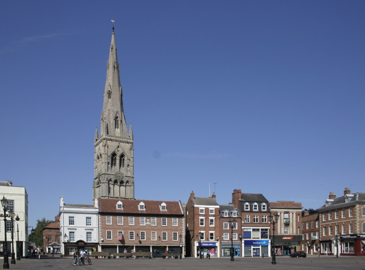

Newark-on-Trent is a city in England, United Kingdom, home to about 30,000 people. This guide covers 1 hotel in Newark-on-Trent. Every one carries a published guest score, and the list below is ordered by it.
- Places to stay in this guide
- 1
- Best months
- June to September
- Nearest airport
- EMA44 km · East Midlands Airport
- Currency
- GBPBritish pound
- Time zone
- Europe/LondonUTC+0, UTC+1 with daylight saving time
- Plugs
- G · 230 V
- Emergency
- 112
- Language
- English
About
About Newark-on-Trent
Newark-on-Trent () or Newark is a market town and civil parish in the Newark and Sherwood district, in Nottinghamshire, England. It lies on the river Trent and was historically a major inland port.
Newark has been a transport hub at least since Roman times. "Fosse Way" swings inland to avoid the Humber but here reaches the River Trent, which is navigable. The town prospered through wool and cloth, and in the early 11th century it was owned by Lady Godiva, she of the legendary naked ride. King John died here in 1216, a year after signing Magna Carta. When the English Civil War broke out in 1642 over the powers of the monarch versus parliament, Newark supported the Royalists.
Wikipedia and Wikivoyage contributors, CC BY-SA 4.0; excerpted.
Things to do
What to see and do in Newark-on-Trent
See
- Newark Castle
- National Civil War Centre
- Newark Air Museum
- Museum of Timekeeping
- The Workhouse
- Southwell Village
- Southwell Minster
- National Holocaust Centre
Do
- Palace Theatre
- Odeon
- Skydive Langar
Wikivoyage contributors, CC BY-SA 4.0; excerpted.
Where to stay
The best-rated places to stay in Newark-on-Trent
Ordered by guest score as each operator publishes it, weighted by the number of reviews so a handful of perfect scores does not outrank thousands of very good ones. Scores are shown on their own scale.
| # | Place to stay | Rooms | Guest score |
|---|---|---|---|
| 1 | Travelodge Newark-on-Trent hotel | ≈ 84 est. | 3.9/5 313 reviews |
Schematic: the city centre in orange, each place to stay as a dot, distance rings in kilometres.
Where to stay
Where the places to stay in Newark-on-Trent are
22 places to stay in this guide with known coordinates, grouped by straight-line distance from the city centre (the point Wikidata gives for Newark-on-Trent), nearest first. Distance on foot or by road is longer.
11 places
- 34 Market Place · 0.1 km
- Ram Hotel · 0.1 km
- Crown And Mitre Hotel · 0.2 km
- Elmhurst Hotel · 0.2 km
- Travelodge Newark-on-Trent · 0.2 km
- Robin Hood Hotel · 0.2 km
- Fosseway Hotel · 0.2 km
- Newark Royalist Hotel · 0.2 km
- Ossington Coffee Tavern · 0.2 km
- Millgate House Hotel And Adjoining Boundary Wall · 0.5 km
- South Parade Hotel And Attached Boundary Wall · 0.6 km
8 places
- Newark Lodge Guest House · 3.1 km
- Edgefield House Hotel And Boundary Wall · 5.7 km
- Cross Keys Inn · 6.3 km
- Pack Horse Inn · 7.9 km
- Wheatsheaf Inn · 9.6 km
- Admiral Rodney Hotel · 9.7 km
- Crown Hotel · 9.7 km
- Saracen's Head Hotel · 9.7 km
3 places
- Ayrshire House Hotel · 10.1 km
- The Staunton Arms Public House · 10.2 km
- OYO Belvoir Hotel · 16.0 km
Where to stay
More hotels in Newark-on-Trent
21 hotels within 25 km of the centre, as recorded in Wikidata. Each name links to its encyclopedia article where there is one.
| Hotel | Opened | From centre |
|---|---|---|
| Ossington Coffee Tavern | 0.2 km | |
| 34 Market Place | 1500 | 0.1 km |
| Admiral Rodney Hotel | 9.7 km | |
| Cross Keys Inn | 6.3 km | |
| Crown Hotel | 9.7 km | |
| Newark Royalist Hotel | 0.2 km | |
| Pack Horse Inn | 7.9 km | |
| Ram Hotel | 0.1 km | |
| Robin Hood Hotel | 0.2 km | |
| Saracen's Head Hotel | 9.7 km | |
| The Staunton Arms Public House | 10.2 km | |
| Wheatsheaf Inn | 9.6 km | |
| Ayrshire House Hotel | 10.1 km | |
| Crown And Mitre Hotel | 0.2 km | |
| Edgefield House Hotel And Boundary Wall | 5.7 km | |
| Elmhurst Hotel | 0.2 km | |
| Fosseway Hotel | 0.2 km | |
| Millgate House Hotel And Adjoining Boundary Wall | 0.5 km | |
| Newark Lodge Guest House | 3.1 km | |
| OYO Belvoir Hotel OYO Rooms | 16.0 km | |
| South Parade Hotel And Attached Boundary Wall | 0.6 km |
All 22 hotels in Newark-on-Trent, with their history and operators
Where to stay
More places to stay around Newark-on-Trent
Overture Maps and OpenStreetMap list 55 further hotels and other places to stay in the Newark-on-Trent area; none of them has a star rating and none has a room count.
By type: 48 hotels, guest houses, hostels and similar, 6 holiday rentals and apartments and 1 listed only as lodging.
The area is everything within 25 km that is nearer to Newark-on-Trent than to any other destination in this guide. Places this guide already names are not counted again; a place listed by two sources under different names can be counted twice.
Sources: Overture Maps Foundation, places theme, release 2026-09-23.1 (CDLA Permissive 2.0); © OpenStreetMap contributors (ODbL 1.0), data of 21 September 2026.
Things to see
Things to see near Newark-on-Trent
Places of interest within 3 km of the centre of Newark-on-Trent, ranked first by how widely they are covered in Wikipedia (one of them has an article), then the others, those linked to Wikidata first, by type of place and distance. Distances are in a straight line.
- Newark Castle castle · 0.2 km
- Newark Town Hall Museum and Art Gallery museum · 0.0 km
- National Civil War Centre museum · 0.3 km
- Queen's Sconce attraction · 1.2 km
- Sconce and Devon Park park · 1.2 km
- Beacon Hill peak · 1.7 km
OpenStreetMap maps 14 restaurants, 18 cafes and 22 bars and pubs within 3 km of the centre.
Source: © OpenStreetMap contributors (ODbL 1.0), map data of 21 September 2026; links to Wikidata.
Nature
Nature near Newark-on-Trent
Protected areas within 50 km
- Woodhall Spa Meadow SSSI · 41.1 km
- Kirkby Moor SSSI site of special scientific interest · 42.6 km
- Lincolnshire Wolds National Landscape 46.9 km
- Peak District National Park national park · 49.2 km
Source: © OpenStreetMap contributors (ODbL 1.0), map data of 21 September 2026; links to Wikidata.
When to go
The best time to visit Newark-on-Trent
The most comfortable months for a city stay in Newark-on-Trent are June to September. July is the warmest month, with average highs of 22 °C; August is the wettest, with about 62 mm of rain.
Comfortable means average daytime high between 18 °C and 29 °C and under 80 mm of rain in the month. Averages for 1991-2020 over the surrounding area, a grid square about 50 km across, so a coast or a nearby mountain can make the town itself warmer or cooler. Data: CRU TS v4.10, Climatic Research Unit, University of East Anglia (Open Database License).
Newark-on-Trent travel calendar 2027: every day with public and school holidays, sunrise and sunset and the typical high and low (also as JSON).
Public holidays in United Kingdom, 2026
Shops and offices may close on these dates.
Getting there
Getting to Newark-on-Trent: airports and arrival
The nearest airport with scheduled flights is East Midlands Airport (EMA), about 44 km from the city centre in a straight line; Humberside Airport (HUY, 63 km) and Birmingham Airport (BHX, 94 km) are also within reach.
Getting in
The nearest airport is East Midlands Airport (EMA) (30 miles, 50 km). This has good connections across West Europe, including Edinburgh, Glasgow and Belfast. For anything further afield, use the London airports. A shuttle bus connects EMA with East Midlands Parkway railway station, with direct trains to Newark Castle. EMA airport buses also run from Nottingham, Derby, Leicester and Loughborough.
Getting around
The town is best explored on foot. The countryside around is flat and cyclable, but the roads are busy. Take bus 28 / 29 for the Timekeeping Museum, Workhouse and Southwell. You can either ask for “SUH-thell” or “South-well”, both pronunciations are used locally. Local buses run frequently to Hawtonville, Balderton and the northern industrial estates. Taxis wait at Northgate station.
Wikivoyage contributors, CC BY-SA 4.0; excerpted.
Getting around
Getting there and around Newark-on-Trent by rail and ferry
Rail from the airports
Rail, metro and tram lines that call at a station at the airport, as mapped in OpenStreetMap.
- BHX · Birmingham AirportRail (National Rail): Birmingham International => Aberystwyth, BMH-MAN, Chase, LNWR, MAN-BMH, VT A, VT B, XCRail: Holyhead => Birmingham International
Source: © OpenStreetMap contributors (ODbL 1.0), map data of 21 September 2026.
Local knowledge
Eating, drinking and staying safe in Newark-on-Trent
Stay safe
Newark is relatively safe. Places to avoid at night include Yorke Drive (near Northgate Railway Station), Devon Road (on Hawtonville Estate) and Sconce Hills Park.
Wikivoyage contributors, CC BY-SA 4.0; excerpted.
Good to know
Accessibility, parking and families in Newark-on-Trent
How many places to stay in this guide state each, as their operators or their own websites publish it.
of 1 place
of 1 place
Questions
Newark-on-Trent: questions travellers ask
What are the best-rated hotels in Newark-on-Trent?
By published guest score: Travelodge Newark-on-Trent (3.9 / 5 · 313 reviews · www.travelodge.co.uk (operator's own guest score)).
When is the best time to visit Newark-on-Trent?
The most comfortable months for a city stay in Newark-on-Trent are June to September. July is the warmest month, with average highs of 22 °C; August is the wettest, with about 62 mm of rain.
Which airport is closest to Newark-on-Trent?
The nearest airport with scheduled flights is East Midlands Airport (EMA), about 44 km from the city centre in a straight line; Humberside Airport (HUY, 63 km) and Birmingham Airport (BHX, 94 km) are also within reach.
What currency is used in Newark-on-Trent?
The British pound (GBP), per Unicode CLDR.
Nearby
Destinations near Newark-on-Trent
Sources: city facts from Wikidata and Wikipedia; airports from OurAirports; climate from CRU TS v4.10 (University of East Anglia Climatic Research Unit), 1991-2020 monthly means, 0.5° grid; public holidays from python-holidays (MIT); currency and official languages from Unicode CLDR (Unicode License v3); time zone from the coordinates (timezone-boundary-builder, ODbL) with offsets from the IANA Time Zone Database; places to stay and guest scores from each operator's own public pages; amenities from the operators' own listing data. How this guide is made.